8 Best Road Trips from Seattle
Highway 20 cuts through the heart of the North Cascades. Photograph by Mac Holt.
The road trip is about the journey, never more so in a time when the faraway remains largely off-limits. Fortunately, Washington’s highways contain miles of scenic grandeur and peculiar history, telling us endless new stories through the windshield. For these routes—the state’s most stunning stretches of blacktop, plus a few detours on dirt—you will know you’ve arrived when you’re still moving and realize you never want to stop.
Jump to Your Route:
Moses Coulee / The Gorge / Palouse / Chuckanut Drive / Olympic Peninsula / North Cascades / Mount Rainier National Park
Beachfront Property
Long Beach from Seaview to Oysterville
Starting point: 170 miles from Seattle

The Route
Freeways have on-ramps, but beaches have access roads. Those in Long Beach, Klipsan Beach, Ocean Park, and Surfside Estates—a 13.5-mile stretch—allow cars all year long, but sections both north and south close April 15 through Labor Day (some open during razor clam season). Closed sections may protect habitat for snowy plover birds.
The best beach drives happen outside of prime kite-flying season in the summer, and with an eye on the tides. Try entering at Cranberry Road and heading north, avoiding the crowds of Long Beach proper, then circling back to town on regular roads for Dylan’s Cottage Bakery’s signature sweets.
Just because one can legally drive on the beach doesn’t mean one should floor it on the beach—a lesson often learned on the flat expanse of the Long Beach Peninsula, where the sand is, technically, a Washington state highway. Much, but not all, of the 28-mile Pacific Ocean frontage allows cars, though drivers must stick to speeds less than 25 miles per hour, with doughnuts and swerves through the surf prohibited.
Turns out that unlike, well, most every other state route and highway, the beach can be cut with streams that create tiny sand canyons, hard to spot when navigating in the dark. That little lip of sand can wreak havoc on the underside of a vehicle (yes, that’s personal experience talking). Particularly since tides partly dictate the rare open razor clam harvests, meaning sometimes the hordes of cars descend onto Long Beach in the middle of the night. Just know that the town of Seaview, on the south end of the peninsula where it links to the mainland, contains an auto parts store. Staff there see undercarriage damage regularly.
The beach highway’s novelty makes up for all its dangers. Several stretches of Washington coastline operate under these rules—Copalis up north even includes an airstrip on the sand—but Long Beach’s length outshines the others.
Long Beach is the state's sandiest road.
Deep Cuts
Moses Coulee from State Route 28 to Highway 2
Starting point: 173 miles from Seattle

The Route
From State Route 28 east of Wenatchee, Palisades Road dives straight into the coulee where it meets the Columbia River. After an unpaved section that crawls up the coulee’s side, arrow-straight country roads form the route before dipping back down into the canyon. Eventually the northward route meets Highway 2, a solid east-west link for travel to Grand Coulee Dam or back to Wenatchee, though a quick detour farther north on Jameson Lake Road continues the sojourn up the undeniably grand Moses Coulee.
Grand Coulee gets all the attention: one of the largest dams in the world, name-checked in a Woody Guthrie song. And while Grand Coulee lives up to its reputation, next-door Moses Coulee is the sleeper showstopper.
The story of Moses Coulee begins in the Missoula Floods of the last ice age, about 14,000 years ago. A gush of water from Montana scoured the landscape, exposing vertical walls of basalt in a wide gorge. The Channeled Scablands name may not roll off the tongue—and might be why the region rarely gets its due—but it’s an evocative and not inaccurate descriptor for the sharp angles and deep grooves of the state’s middle north.
Coulee namesake Chief Moses (or Quetalican) of the Sinkiuse-Columbia tribe lived a remarkable life—he visited Washington, DC, twice in treaty negotiations and shook President Rutherford B. Hayes’s hand. Though the chief was likely born within the coulee itself, the U.S. forced Moses and his people off their ancestral lands, eventually to the Colville Reservation.
The Nature Conservancy allows hiking access to some of its 30,000-acre Moses Coulee and Beezley Hills Preserves.
Today small farms dot the perfectly flat coulee floor in the formation’s southern half, a few fruit orchards and tall windbreak trees around the houses. Otherwise, scattered sagebrush fills what feels like a long, thin rock quarry, one that stretches north 40 miles. Sections of the single road are unpaved, the washboard ridges of the hard dirt as even as the basalt pillars that form the coulee edges like ramparts of a medieval castle.
As this meandering, square-edged valley winds northward, mailboxes become fewer, and the final section opens to a nature preserve notable for protecting more than a dozen species of bats, along with the unique shrub-steppe habitat.
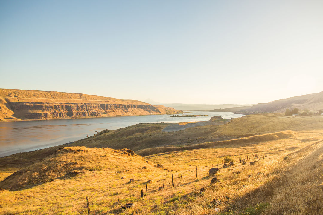
State of the Gorge
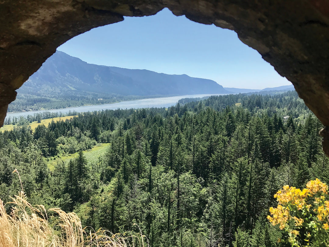
Highway 14 from Camas to Maryhill
Starting point: 176 miles from Seattle

The Route
Though Highway 14 is an unbroken tether from one end of the Gorge to the other, it’s halted by stoplights and small towns along the entire route. Cities on the Oregon side dwarf most Washington settlements, but Stevenson, Bingen, and Lyle have restaurants.
Oregon and Washington each boast roads that trace the length of the Columbia River Gorge, two practically parallel lines on either side of the water. While Oregon’s Interstate 84 is faster, our state’s mostly two-lane road takes its time; the Lewis and Clark Highway was named for explorers who took more than a month to traverse this section of their Pacific expedition. The 90 miles from Camas, just east of Vancouver, to Maryhill can be counted in a series of spectacular riverfront state parks.
Beacon Rock State Park
How do we know the Washington side of the Gorge rules? Because the top of our 848-foot Beacon Rock, a volcanic remnant with a mile-long hiking trail, offers a perfect view of…Oregon. Plus, of course, the entire river, dotted with islands, and forests recovering from the brutal 2017 wildfire. Closer are the climbers who scale the rock’s northwest face—likely to the bemusement of the falcons that nest on adjacent crags.
Beacon Rock sits high above the Columbia River Gorge.
Spring Creek Hatchery State Park
The fish born here offer little entertainment value, though the state hatchery next door offers free self-guided weekday tours. More thrilling: Windsurfers and kiteboarders perform water-top acrobatics on one of the best windy sites in the world. The park itself is tiny but an ideal spot for tearing into takeout from Everybody’s Brewing, just down the road in White Salmon.
Columbia Hills State Park
When the slopes above the river fill with balsamroot blooms in May, lupine flowers serve as bright purple contrast. The sight rivals any along the Gorge for pure natural beauty. Closer to the river’s edge, Horsethief Butte towers over a small inlet, home to Native American pictographs and petroglyphs.
Maryhill State Park
The charms of the Gorge’s placid eastern park lie mostly in its proximity to the area’s eclectic attractions: Maryhill Art Museum, in a mansion seemingly plucked from the English countryside. A replica of Stonehenge, an incongruous sculpture, lonely on an otherwise empty bluff. Tidy rows of fruit orchards, squeezed into a few flat acres between the Columbia and the rolling hills that rise as bald ripples, far into the horizon.
Forests give way to grasslands at the east end of the Columbia River Gorge.
Image: Mac Holt
Palouse Pretty
Highway 195 and State Route 26 from Rosalia to Palouse Falls
Starting point: 291 miles from Seattle

The Route
From Rosalia, Highway 195 goes south to tiny Colfax, home to a modest downtown. State Route 26 then travels west through quiet farmland to Washtucna, where State Routes 260 and 261 make a southern hook to Palouse Falls State Park.
We can explain the deja vu: The undulating grasslands of the Palouse, bright with spring green under a baby blue sky, look just like Microsoft’s most famous desktop backdrop. But on any random mile south of Spokane, the farmland exudes a kind of serenity that no Windows product ever managed. The arched Rosalia bridge complements the rolling farmland, oozing pastoral calm.
The modest Steptoe Butte nearby would barely register if you set it against the peaks of the Cascades, but around here the triangular knoll towers over an otherwise nearly flat landscape. The quartzite underfoot predates the surrounding land by millions of years, a little island of bedrock sticking up among layers of newer sediment.
The Palouse, wedged between wine country and Spokane, can be a forgotten puzzle piece among the state’s more dramatic sections. The region stretches into Idaho, the swath of grassland best known for twin public universities and agricultural production. But placards in Rosalia note a darker history: An 1858 battle between U.S. Colonel Steptoe and united bands of Native Americans led to a brief Indigenous victory of sorts, before the military crushed rebellion against white settlement in the fertile expanse.
The miles southwest of Rosalia evoke classic Americana, the kind of picturesque barns and grain silos most often associated with the bucolic American Midwest. But detour south to the abrupt Palouse River Canyon and natural features assert themselves. For all the churning fury of Palouse Falls, a 200-foot cascade, it’s hard to imagine the river carving so deep a channel. And it didn’t—erosive ice age floods carved a gutter so deep, a river redirected into the shortcut, straight to the Snake River. Around here, nature plays the long game.
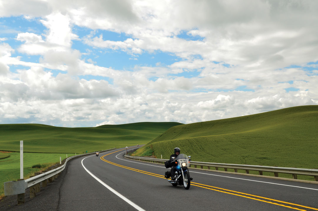
The rolling landscape of the Palouse makes for easy riding.
Chuckanut Buffet
Chuckanut Drive from Burlington to Bellingham
Starting point: 66 miles from Seattle

The Route
From Burlington, the most scenic route goes west on State Route 20 before heading north at Bayview Edison Road. After a dogleg through Bow turns the arterial briefly into Bow Hill Road, it meets Chuckanut Drive at a crossroads called Edison Station. From there, the drive moves due north.
The road that hugs the Puget Sound coastline south of the Bellingham neighborhood of Fairhaven spans only about 25 miles, but it presents a veritable feast.
Consider the small town of Bow near the route’s southern end, perhaps the best exemplar of bang-for-your-buck virtue—a whole small town of charm packed into a block and a half. Breadfarm Bakery, with its soft chocolate vanilla sandwich cookies and bread made with potatoes grown in the Skagit Valley, is a destination unto itself. Terramar Brewstillery juggles beer, booze, and pizza in one spot, and the Longhorn Saloon offsets the tidy boutiques and art galleries of the surrounding businesses with good old-fashioned fried food and local gossip.
Bald eagles seem to have a taste for this flat farmland too; so many raptors crowd the tree branches that it’s not unusual for a line of parked cars to form along the otherwise unremarkable rural Bayview Edison Road south of Bow. To join, simply pull over and gaze in whatever direction the binocular brigade faces.
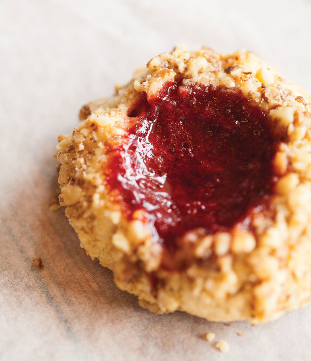
A jammy Breadfarm treat.
Image: Olivia Brent
But north, where State Route 11 officially becomes Chuckanut Drive, it abandons the straight lines of a grid to trace the bumpy coast of Samish Bay. Only a few feet of waterfront separate the steep bluffs and the inland hills, though Chuckanut Manor—dishing cioppino and truffle fries on white tablecloths—finds room for multiple outdoor patios.
Tables are less formal at Taylor Shellfish Farms, where harvest facilities and a fresh market share weather-worn buildings between piles of discarded shells. The patio feels untouched by pandemic abridgment: draft beer from a Bellingham brewer and a ring of freshly shucked bivalves on ice, just as salty as the sea air. Eye a grilled dungeness crab over the wood fire pit and you’ll end up ordering your own.
Though the drive offers peekaboo views to the moody Puget Sound waters, a strenuous hike from the roadside earns you a fuller panoramic atop Oyster Dome. From here, the San Juan Islands emerge from the Salish Sea in a series of dark humps in the distance.
Back down at Chuckanut, the road meanders through Larrabee State Park—more hiking trails, more overlooks—before landing in Fairhaven, a funky enclave of bookstores and cafes, student-friendly burrito joints and upscale gelato shops. Though the road trip may be bite-size in length, the biggest risk is leaving overfull.
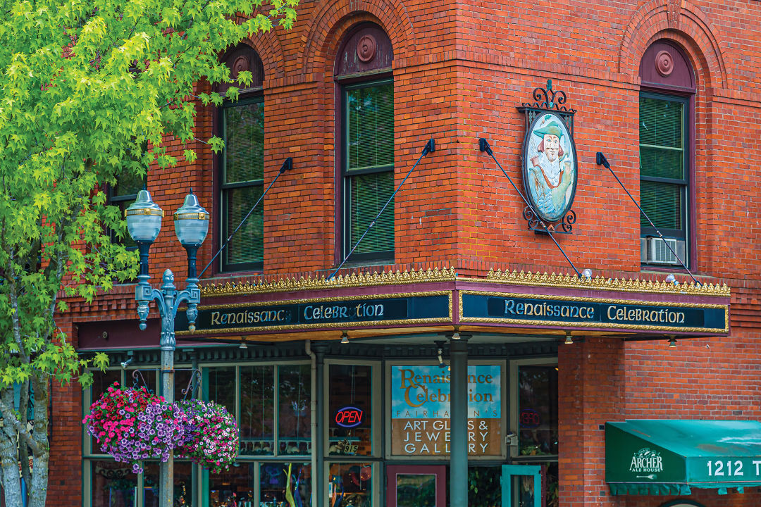
Chuckanut Drive ends in a charming Bellingham neighborhood.
Olympic Fanfare
Highway 101 from Port Angeles to Kalaloch
Starting point: 82 miles from Seattle

The Route
The blissfully simple Highway 101 serves as the central artery for the Olympic Peninsula. Most detours mean an out-and-back trip, though the main route itself offers plenty of scenic pullouts. Port Angeles and Forks are the only towns with multiple services.
No one argues that the Olympic Peninsula stands as one of the few truly unmissable gems of Washington. A better question: What do we mean by the Olympics? The peaks, the beaches, the rain forests, the history—“all of the above” overwhelms, but the mighty 101 delivers an intro to each.
The highway makes a near-complete loop around the square peninsula, like a clock that’s only missing the six. That makes midnight, or the city of Port Angeles, the ideal launchpad. From the onetime gritty lumber town, Olympic National Park options immediately shoot off the highway into the interior. Choose your own adventure: Hurricane Ridge for snow-capped mountains and alpine meadows. The Elwha River for the reclaimed waterway where record-size salmon once spawned (and may again since its dam was removed in 2012). Or Lake Crescent, the state’s second deepest—so much so that the Space Needle could fit upright beneath its surface.
The hits keep coming. Sol Duc Hot Springs, where the hot waters feed man-made swimming pools but nearby falls remain misty, untouched cascades. In Forks, a longer detour follows the Sol Duc River until it meets the flowing Bogachiel and empties into the Pacific. There, Rialto Beach faces iconic sea stacks, partially eroded rock formations pounded by ocean waves.
Back on 101, a different spur south of Forks heads east into the Hoh Rain Forest, a mossy temple of old growth so peaceful that it’s home to the so-called quietest square inch in the country.
Finally, in less than 100 miles, the highway reaches the park’s most accessible ocean beaches. At Kalaloch, the dangling roots of a Sitka spruce, airy where the beachfront has eroded underneath it, draw admirers who call it the Tree of Life.
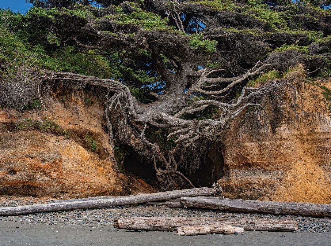
The ever-changing coastline at Kalaloch Beach.
Northern Composure
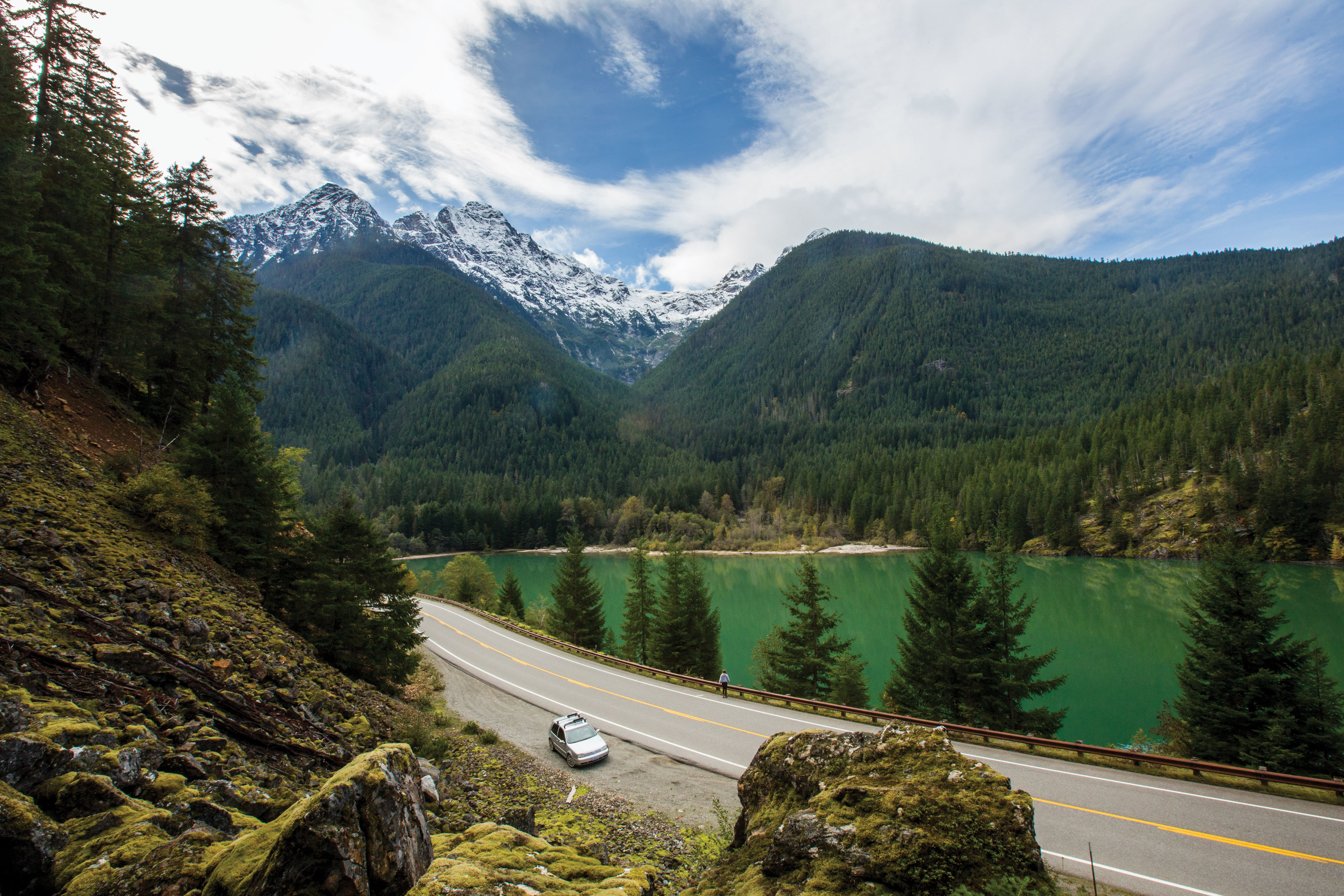
State Route 20 from Marblemount to Mazama
Starting point: 101 miles from Seattle

The Route
Marblemount serves as the last bastion of commerce and cell coverage on an eastbound trip; a smattering of restaurants dish comfort food. To the east, the orderly company town of Newhalem, mostly Seattle City Light facilities, gives way to tight road curves above the electric blue of Diablo Lake. Highway 20 barrels east before it descends into the ponderosa pine forest of the Methow Valley, home to the Mazama Store’s beers and baked goods.
The state’s absolute best road—a subjective distinction, to be sure—closes for half the year. WSDOT gates block North Cascades Highway at either end around Thanksgiving as monumental snows stack on the pavement. It remains shuttered through the winter, hibernating like the (very few) grizzly bears that roam the thick wilderness, which stretches in both directions.
Spring comes late to the high elevations; avalanches still release torrents of snow onto the route as crews begin clearing from the ends. The highway usually reopens by mid-May, once it’s deemed safe—and once guardrails busted by nature get repaired. It’s usually still a tunnel of car-high snow berms at the highest passes. Impressively, the 75 miles of single-lane blacktop deliver any month they’re open, even when it’s too chilly to erect a tent at the North Cascades National Park campgrounds scattered along its length.
Yet for all the natural beauty—glaciers and evergreen forests and roadside waterfalls—the drive delivers a lesson in energy policy too. Serpent-shaped Ross Lake is merely the latest incarnation of what was the Skagit River Valley, visited for 10,000 years by local indigenous tribes. Starting in 1919, dams created reservoirs now known as Ross, Diablo, and Gorge lakes to power Seattle City Light’s massive Skagit River Hydroelectric Project. Around 20 percent of Seattle’s power comes from the manipulation of a landscape that looks untamable from the road.

Save for Summer
Seasonal closures mean some of the state’s high-elevation roads are off-limits in winter months; check wsdot.wa.gov for current conditions.
Glance north up Ross Lake for Desolation Peak, site of a fire lookout once manned by Jack Kerouac. Countless rugged mountains flash by as the route reaches scenic Washington Pass and rocky pillars called Liberty Bell and the Early Winters Spires; pull off at the signed Washington Pass Overlook, as the hairpin turn requires the driver’s full attention. Exit the car at every stop to take in the view, since nearly every lake, peak, and vista stretches far beyond the limit of a single windshield.
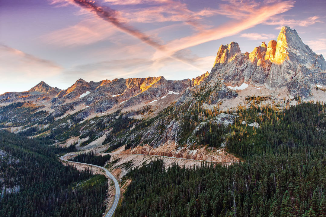
Highway 20’s scenic hairpin turn from Washington Pass Overlook.
Image: Andy Porter
Rainier Survey
National Park Roads from Paradise to Chinook Pass
Starting point: 107 miles from Seattle

The Route
From Paradise, Stevens Canyon Road heads east to meet State Route 123 north of Ohanapecosh; the Grove of the Patriarchs trail there makes for a stomach-settling short hike between windy stretches of road. State Route 123 goes north to meet Highway 410 at Cayuse Pass, and a turn eastward immediately meets two tight switchbacks before curving through Chinook Pass and descending toward the eastern foothills of the Cascades.
To drive Mount Rainier National Park’s perfectly scenic roadways is to marvel at the chutzpah to establish them in the first place. The routes slice upward into the high elevation mountainsides of Rainier’s alpine skirt, through meadows that have earned world records for annual snowfall. When visitation grew nearly tenfold in the 1920s, park officials mapped the web of roads we know today—connecting the south and east sides of the volcano—and began construction even as automobiles were still in the Model T era.
Expertise came from everywhere. Seattle’s Mountaineers club consulted on what natural areas should be made accessible, and one park superintendent brought road-building experience from a stint in American-occupied Philippines. Aesthetics remained key; workmen constructed bridges over Christine Falls and Box Canyon from concrete, then faced them with stone for a rustic look.
The Stevens Canyon Road, perhaps Rainier’s most stunning stretch of blacktop, links the park’s main visitor sites (Paradise, Sunrise, and Ohanapecosh). Its route of stone tunnels and high scenic traverses was one of the last bits of roadway completed, begun under the Great Depression–era Public Works Administration but finished after a break for World War II.
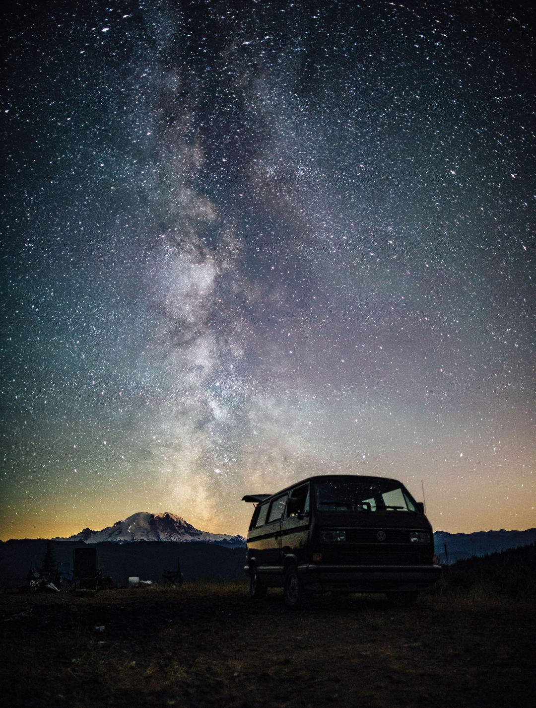
Mount Rainier on a clear night from Chinook Pass.
Image: Joe Tobiason
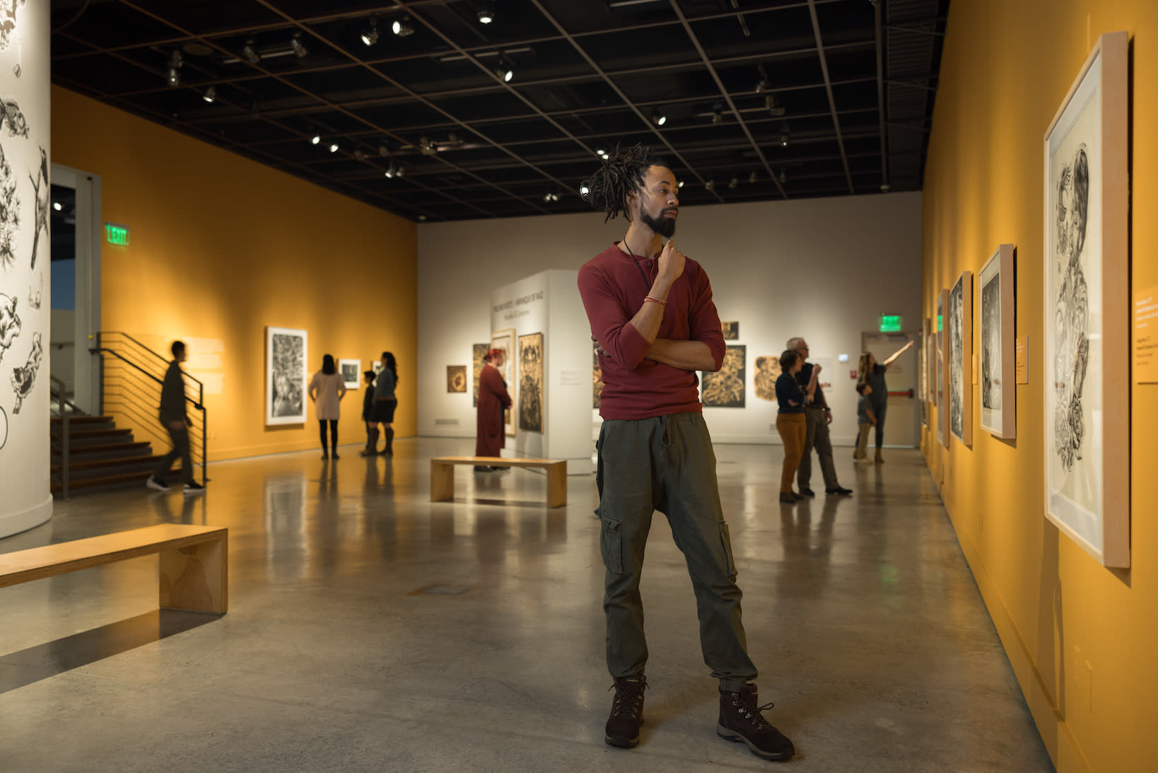
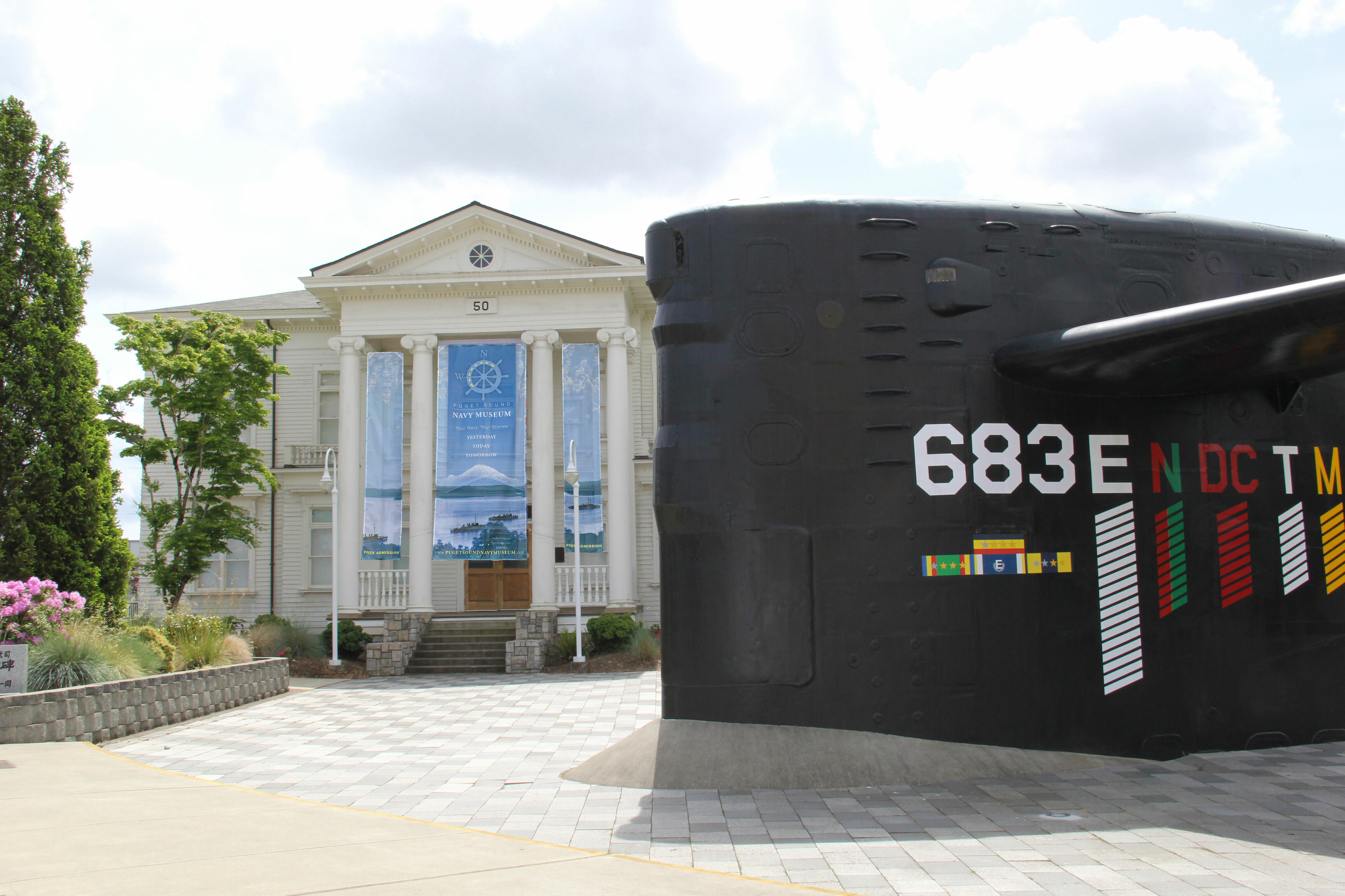
On display
Washington Museums Worthy of a Road Trip
Warm-Ups
Short Winter Day Trips from Seattle
Destination Dossier